Tri-State Flooding & Hurricane Erin: August 2025 Weather Impacts & Safety Guide
Tri-State Weather & Ohio Valley Storms: August 2025 Flood Risk Assessment

August 2025 Weather: Unpacking Flood Risks and Regional Impacts
As August 2025 unfolds, the Northeastern and Mid-Atlantic United States are grappling with significant weather challenges. Intense heavy rainfall and coastal hazards are impacting the Tri-State area (New York, New Jersey, and Connecticut), while the Ohio Valley experiences severe storms leading to localized flooding. This comprehensive analysis, drawing insights from CBS News, AccuWeather, and WSAZ News, delves into the latest weather forecast, the associated flood risks, their widespread regional impacts, and crucial safety precautions. Stay informed about the evolving Tri-State weather and Ohio Valley storms to ensure preparedness.
Tri-State Weather Alert: Heavy Rain and Hurricane Erin's Indirect Flood Threat
The Tri-State area (including New York weather, New Jersey weather, and Connecticut weather) is currently under a "First Alert Weather Day," facing a dual threat from heavy rainfall and the indirect impacts of Hurricane Erin. Although Hurricane Erin is projected to remain offshore and is not expected to make landfall, its powerful presence is intensifying existing weather systems. This atmospheric synergy significantly increases the risk of dangerous flash flooding and additional coastal hazards across the region.

- Rainfall Forecast: Current weather forecasts indicate rainfall rates could reach up to 1 inch per hour, with total accumulations generally between 1–2 inches across most areas. However, isolated, localized downpours may significantly exceed these amounts.

- Timing: The most intense rainfall is anticipated from Wednesday evening into Thursday. Specifically, New York City is forecasted to receive between 0.5–1 inch, with the bulk of this precipitation occurring overnight.
- Highest Risk Areas: Regions facing the most significant threat of concentrated downpours and flash flooding include the Hudson Valley, central and eastern New York, and areas extending from southern New Jersey to Long Island, as well as southern Connecticut/Rhode Island.


Tri-State Coastal Hazards: High Surf, Dangerous Rip Currents, and Coastal Flooding
Beyond the potential for inland flash flooding, the Tri-State area is also bracing for severe coastal threats, directly influenced by the offshore presence of Hurricane Erin.

- High Surf & Rip Currents: Forecasts predict waves soaring up to 15 feet and the development of life-threatening rip currents. This has led to proactive beach closures across NYC to ensure public safety.

- Coastal Flooding: Low-lying coastal areas could experience inundation of 1–2 feet due to coastal flooding and storm surge.
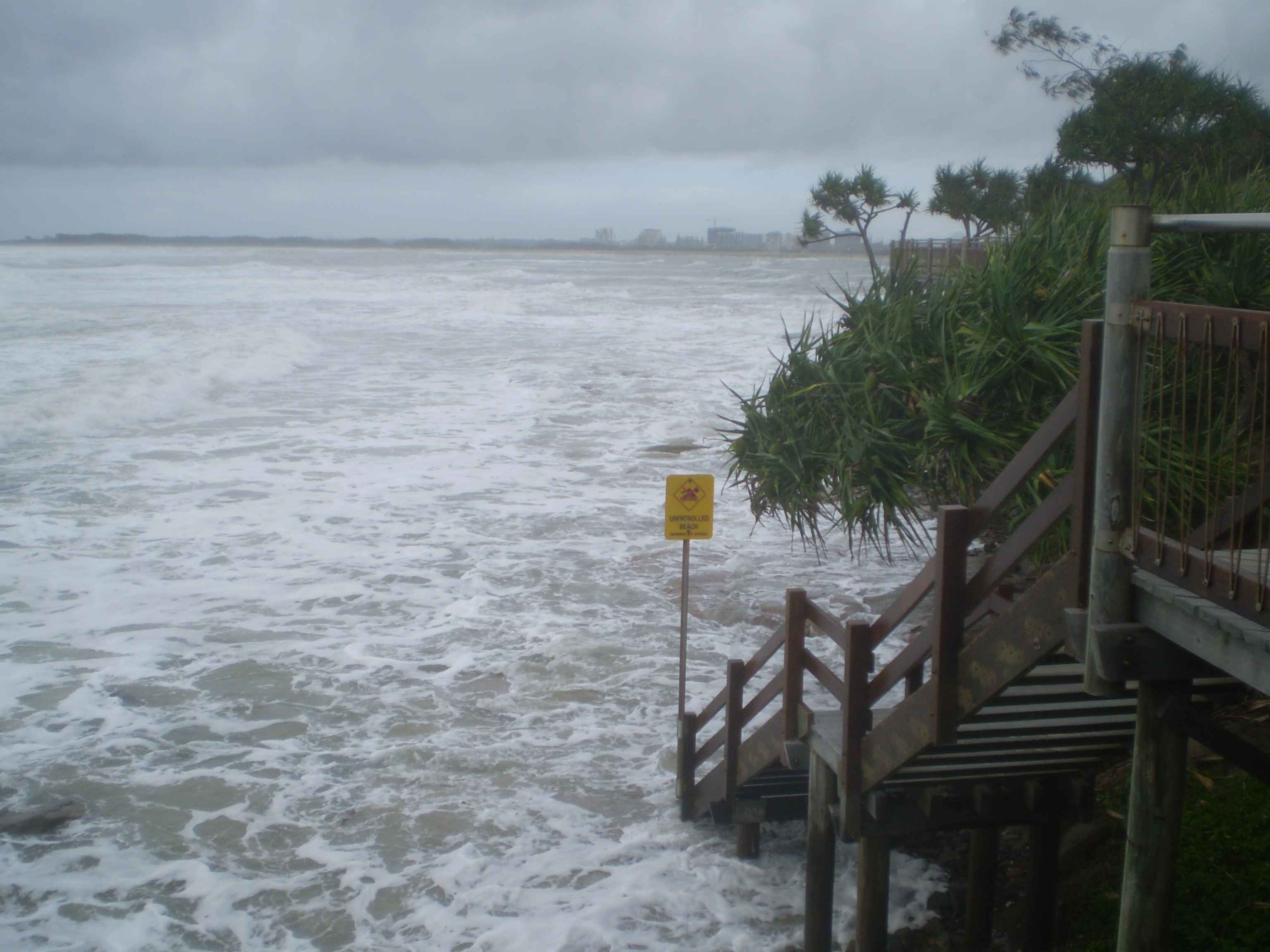
The image shows coastal flooding due to high tides from Cyclone Hamish along the Caloundra, Queensland coast in 2009. “Coastal flooding from Cyclone Hamish in Queensland 2009” — Source: Wikimedia Commons . License: CC BY-SA 3.0 .
- Wind Gusts: Powerful wind gusts, reaching up to 50 mph, are expected along the Tri-State coastline.

- Emergency Measures: In a proactive move, parts of Long Island have declared a state of emergency to prepare for and respond to these anticipated severe weather conditions.

Tri-State Weather Forecast: Regional Flood Risk Variations
- Hudson Valley and Central/Eastern New York: These areas are anticipated to experience the most significant inland flooding and potential flash flooding.
- New York City: Expected to receive 0.5–1 inch of rainfall, with a strong possibility of localized flooding overnight, especially in low-lying urban areas.
- Jersey Shore & Long Island: Residents in these areas should consult detailed local weather forecasts to prepare for specific localized coastal flooding and wind conditions.
- Southern Connecticut/Rhode Island: Identified as part of the highest risk region for concentrated downpours and subsequent flash flooding.
It's important to note that while the current Tri-State weather is influenced by broader patterns, Hurricane Erin’s direct contribution to inland rainfall is expected to remain limited, with its primary impact focused on enhancing coastal hazards like rip currents and high surf.
Ohio Valley Storms: Documenting Record Flooding in Lawrence County
Switching focus to the Ohio Valley, August 14 brought a separate, yet equally impactful, series of severe storms. Lawrence County, Ohio, bore the brunt of this system, with Rome Township recording an astonishing over 7 inches of rain in a single event. This led to significant localized flooding, extensively documented by WSAZ News’ Victoria Ware through on-the-ground reporting.

Although this particular storm system in the Ohio Valley is distinct from the concurrent Tri-State weather challenges, it underscores a broader, concerning trend of intense heavy rainfall and flooding witnessed across the broader region throughout August 2025.
Conclusion: August 2025 Weather Preparedness & Ongoing Monitoring for Tri-State and Ohio Valley
The significant weather events of August 2025 serve as a stark reminder of the vulnerability of both the Northeastern and Mid-Atlantic regions. These areas are susceptible to both direct storm impacts and the complex indirect effects from larger systems such as Hurricane Erin. To navigate these challenges effectively, residents in the Tri-State area and the Ohio Valley must prioritize preparedness:
- Stay informed with the most up-to-date weather forecasts and advisories.
- Follow local authority warnings concerning flash flooding, coastal flooding, dangerous rip currents, and high surf conditions.
- Take precautions to safeguard both property and personal safety, especially in areas prone to flooding or severe winds.
As these dynamic weather conditions continue to evolve, continuous monitoring of Tri-State weather and Ohio Valley storms remains absolutely essential for effectively mitigating risks and ensuring community safety.


myhome
https://www.aymany.com/


